| CITY OF INDUSTRY - PHOTOS | |
 |
 |
|
Flying over Diamond Bar, looking at where Grand Avenue would be flooded in
Upper Tonner Canyon. |
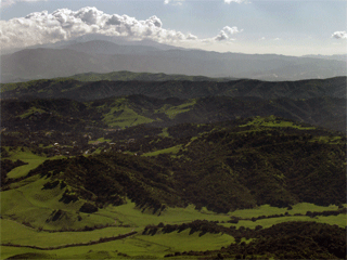
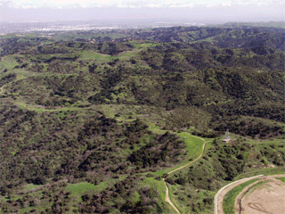
Flying over Industry's property
looking north at Upper Tonner Canyon. |
 |
 |
|
Though public land, the
public is NOT allowed in Upper Tonner Canyon (in Diamond Bar). |
Again, looking south at Upper Tonner Canyon in Diamond Bar. |
 |
 |
|
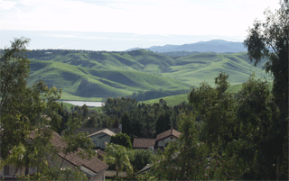
Tres Hermanos from Grand Avenue in Diamond Bar, looking south. |
Tres Hermanos, from Diamond Bar, Cleveland National Forest in distance. |
 |
 |
|
Looking north from Grand Avenue, Tres Hermanos in Diamond Bar. |
From Diamond Bar, the rolling hills of Upper Tonner Canyon. |
 |
 |
|
Over Diamond Bar, looking Middle Tonner Canyon and houses that would view
saddle dams. |
Flying through Tonner Canyon, looking northeast of the Olinda Landfill. |
 |
 |
|
Again, from Rowland Heights, the 57 Freeway is in the distance. |
The location of Industry's proposed road, at Eucalyptus Road in Chino Hills. |
 |
|
|
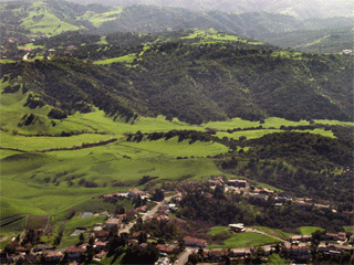
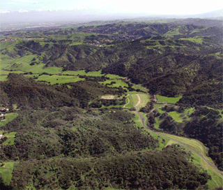
Tonner Canyon from Chino Hills. |
Looking over Midde Tonner Canyon with Chino Hills State Park & the Santa Ana Mountains in the distance. |
 |
 |
|
Flying over the 57 Freeway, looking at Middle Tonner Canyon. |
Flying over the 57 Freeway, looking at oak and walnut covered slopes of Middle Tonner Canyon. |
 |
 |
|
Flying over the Olinda Landfill,
looking at the proposed road alignment to connect Brea to Chino Hills. |
Over the 57 Freeway, looking at Lower and Middle Tonner where one of the massive dams would be located. |
 |
 |
|
Over Diamond Bar, looking Middle Tonner Canyon and houses that would view
saddle dams. |
Flying over Brea, looking at the
degraded lands of Lower Tonner Canyon. |